Learn & Explore
Education embedded in cutting-edge research
Connecting Disciplines
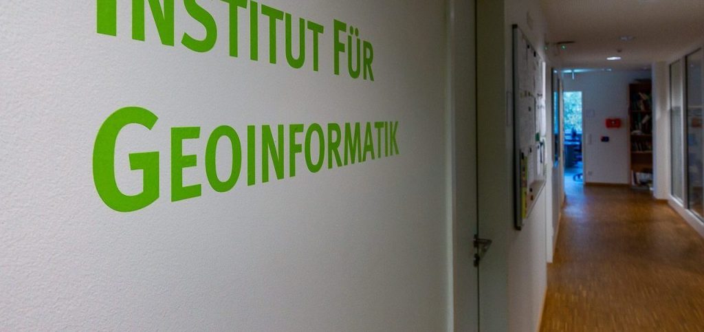
Computer Science meets Geosciences
Study at ifgi
M.Sc. in Geoinformatics and Spatial Data Science
The study program
Our goal is to educate students in the most advanced techniques in geographic information processing. Building on a Bachelor of Science in Geoinformatics or a related discipline, the Master of Science in Geoinformatics and Spatial Data Science program will further develop the student’s problem-solving skills, analytic capabilities, and teach innovative and creative scientific research methods. As one of the leading places for exploring new frontiers in geospatial information science, the Institute for Geoinformatics Münster provides Master students a chance to get personally involved in cutting-edge research projects. This opens opportunities to conduct Master theses on new and emerging technologies. Obtaining a Master’s degree from the Institute for Geoinformatics will prepare you for a leading position in industry and academics. Medium of instruction is English.
At a glance
Degree: Master of Science (M.Sc.)
Type of study: full time
Duration: 4 semesters
Credit Points: 120 ECTS
Start: winter or summer
Application deadline:
Non-EU applicants: November 30th (summer semester), May 31st (winter semester)
EU applicants: January 15th (summer semester), July 15th (winter semester)
Language: English
Fees: no tuition fees for the study program, you only pay the university´s semester fee
Quick info
- you have a bachelor´s degree in Geoinformatics or a geographic information science related field (including information systems and computer science)
- you want to become part of an interdisciplinary research community at the intersection of informatics and spatial data science
- you want to receive your education at one of the leading Geoinformatics institutes world-wide
- you want to learn scientific methods in a practice-oriented way, with close links to running research projects
- you enjoy an English study program, embedded in an international learning environment of international students and teachers
- you want to live in one of the most livable cities world-wide
- you enjoy studying in a city with a university that has ~45000 students studying in a wide range of about 120 disciplines, and that offers a vivid and colorful atmosphere
- you like a learning environment that offers a lot of interactions with teachers and researchers at the institute
Contact
Edzer Pebesma,
Study advisor
Phone: +49 (0) 251 83 33081
edzer.pebesma@uni-muenster.de
Christian Knoth,
Study advisor
Phone: +49 (0) 251 83 33056
christian.knoth@uni-muenster.de
The duration of the study program is four semesters where the course program is completed within the first two semesters.
The entire third semester is reserved for you to sharpen your professional profile. You can either conduct an external semester at a university abroad or gain insights and experience in prospective workplaces in industry government or research institutions (see External semester).
In the fourth semester, you will complete and defend your Master thesis.
In total, the study program comprises a choice of 8 out of 10 modules. The module titles give a first glance of what the thematic focus of each module is.
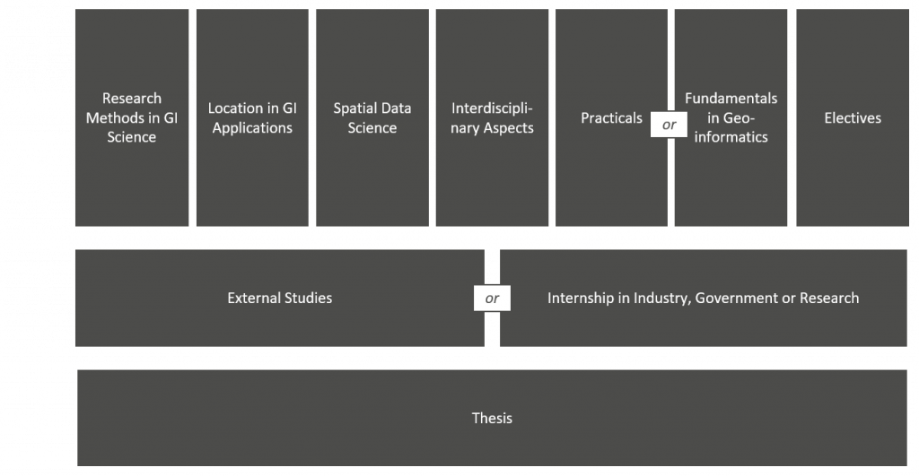
There are different examination formats depending on the type of a course. These can be tests (lectures), presentations (seminars), implementations and written reports (projects), and other…
A full semester (30 CP) is reserved for you to orient yourself within the business world and/or academia.
You can either conduct an external semester at a university abroad or gain insights and experience in prospective workplaces in industry government or research institutes .
In addition, you can complement your study program by choosing courses and workshops on employability offered by the University’s career service.
In addition to regular courses types, we provide study projects where students work in small groups on complex tasks (software development, data analysis) in the fields of Geoinformatics and/or Spatial Data Science. Study projects are embedded in the recent research activities at the institute so that the topics change every semester. Besides technical knowledge, students obtain professional qualifications such as teamwork, project management and communication skills.
Through their Master thesis, students demonstrate that they can actively participate and contribute to scientific progress in their discipline(s). They formulate and solve a specific scientific problem within a the specified time and document their work following the requirements of scientific work and writing. The module includes the written thesis and an oral defence.
The study plan
Semester 1
31 CP
You may choose to replace either this course or “Location Based Services” with an eligible elective course. Courses offered in this module in winter 2025/2026: click here.
You may choose to replace either this course or “Machine Learning for Visual Spatio-Temporal Data” with an eligible elective course. Courses offered in this module in winter 2025/2026: click here.
Instead of this course, you may choose “Spatial Cognition” or “Geoinformatics in Transdiciplinary Education” (both offered in the summer semester)
Click here to see an overview of courses offered in this module in the winter term 2025/2026.
Click here to see an overview of courses offered in this module in the winter semester 2025/2026.
Semester 2
29 CP
You may choose to replace either this course or “Wayfinding and Navigation” with an eligible elective course. Courses offered in this module in summer 2025: click here.
You may choose to replace either this course or “Analysis of Spatio Temporal Data” with an eligible elective course. Courses offered in this module in summer 2025: click here.
Click here to see an overview of courses offered in this module in the summer semester 2025.
Click here to see an overview of courses offered in this module in the summer semester 2025.
Click here to see an overview of courses offered in this module in the summer semester 2024.
Semester 3
30 CP
Semester 4
30 CP
Abbr.: CP = Credit Points (ECTS), L = Lecture, E = Exercise, S = Seminar, P = Project Course, C = Colloquium
Blue boxes indicate courses that are mandatory and offered once a year only. These courses need to be taken in the semester indicated in this study plan.
Green boxes indicate courses that can be chosen from an agreed course program. The current course offering can be found in the corresponding modules.
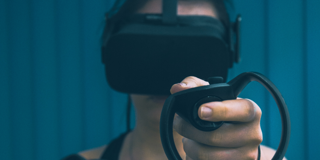
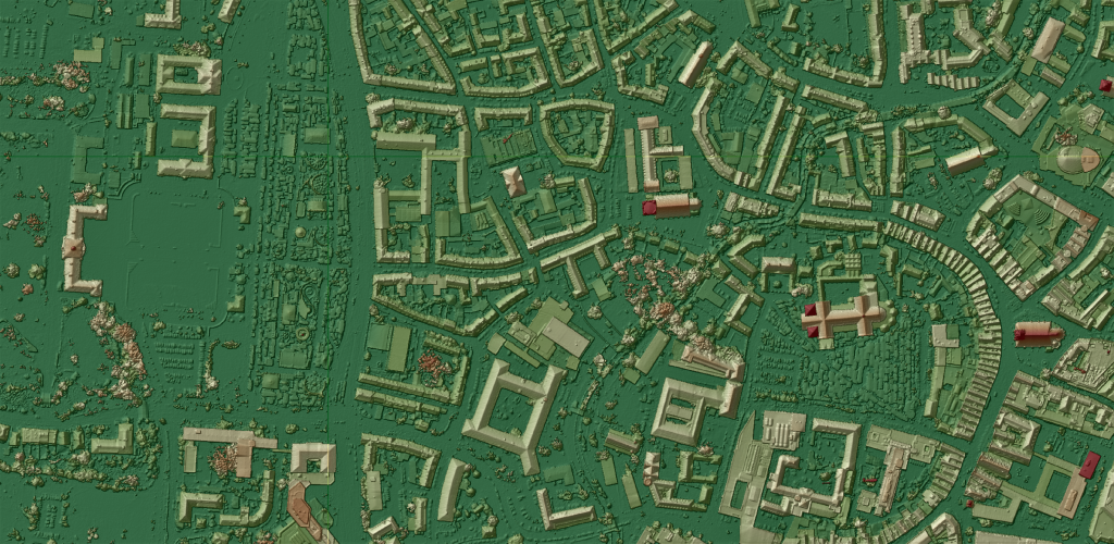
Insights into the study program
Perspectives
Career prospects
Our study program will prepare you for a leading position in industry, administration or academia. If you wish to further deepen your scientific qualification after completing your MSc, you can pursue a PhD in Geoinformatics.
PhD in Geoinformatics
The Graduate School for Geoinformatics offers a structured doctoral programme encompassing a variety of allied disciplines. Please follow the link for more information.

International Experience
Study Abroad
Depending on previous experience and professional goals, you can program your external study semester individually. It is typically an exchange semester at a university abroad, involving an individualized study program and/or project work in a local research group. A learning agreement defines the goals and contents as well as the relative work load of course and project work. Here you further develop your professional profile including soft skills like independent and self-organized work, multi-cultural awareness and competencies, communication skills, networking, career planning and preparation of scientific (thesis) work.

Internship in Industry, Government or Research
Depending on your goals and personal interests, you carry out a practical semester in industry, research institutions or the public sector. Goals and contents of the practical semester are established in a written agreement in accordance with a local supervisor and the module responsible at ifgi. During the five months stay in or outside Germany, you gain experience with political-legal, scientific, social and psychological boundary conditions of professional practice, and develop the necessary qualities such as communication capabilities, planning capability, cooperation with non-experts, and the ability to recognize relevant aspects in complex situations.